ORMAP is a website provided by the State of Oregon that features aerial images of all the tax-lot boundaries in that state.
With most lots we have included a non-interactive image showing the features of Ormap. See it on our inventory page.
If you want to use the full features of Ormap, including the Pan and Zoom, you will need to go to directly to the Ormap web site.
How to use ORMAP web site to pan and zoom lots and boundaries.
- You must have the LAT and LONG coordinates for the lot you wish to view
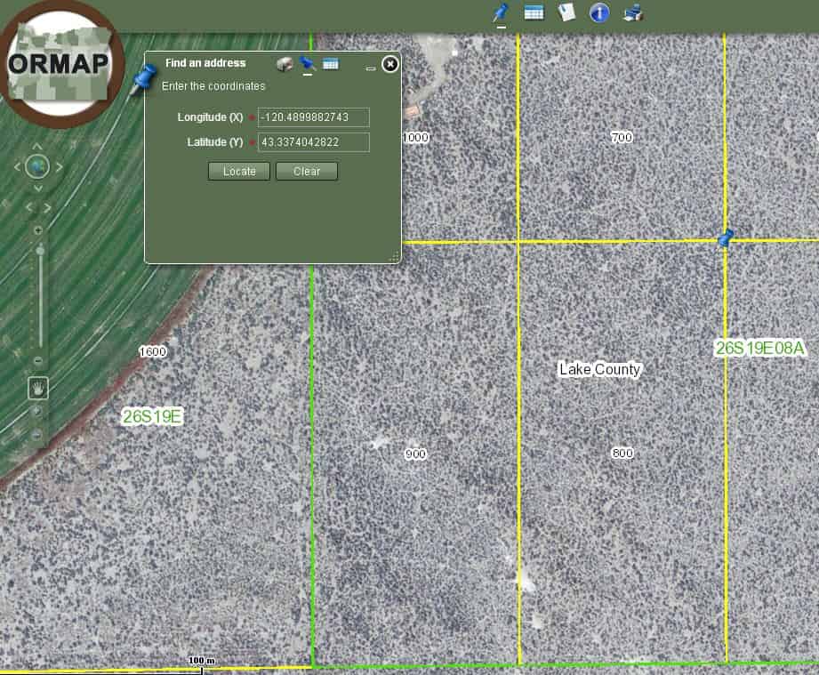
Go to our Inventory page, click on the GEO map icon for the lot you wish to view and copy any set of LAT/LON coordinates shown for that lot. Also make a note of the New Tax Lot number - Open ORMAP, click the blue push pin to open the “Find An Address” box (click the pin within this box to search by Lat/Lon)
- Enter your LAT/LON into the text boxes and click the Locate button
- The map will zoom to the location and show the lot with the boundaries outlined
Use the New Tax Lot number to verify which corner you located - Zoom or Pan the view as needed
Below is an example of using the ORMAP. This is not the actual ORMAP. You can find the actual ORMAP here.